Flood Elevation Certificates

Essential Documentation For Flood Insurance And Compliance

We love to partner with communities.

Lumsden Associates, P.C. provides accurate flood elevation data to protect your property and ensure regulatory compliance in Roanoke, VA, Salem, VA, and surrounding areas.

Lumsden Associates, P.C. provides reliable Flood Elevation Certificate services for property owners, real estate professionals, and builders across Roanoke, Salem, and surrounding areas. Whether you need an elevation certificate for flood insurance, new construction, or FEMA compliance, our team delivers precise surveys to help you navigate the complexities of floodplain management.

With decades of experience and advanced surveying tools, we ensure you have the documentation needed to make informed decisions and protect your investment.

What Is a Flood Elevation Certificate?

A Flood Elevation Certificate (FEC) is an official document that provides critical information about a property’s elevation relative to the Base Flood Elevation (BFE) determined by FEMA. It identifies flood risk and is often required for:

  • Flood Insurance Policies: Determining flood insurance rates or eligibility for coverage.
  • New Construction: Ensuring compliance with local floodplain management regulations.
  • Flood Zone Verification: Confirming if your property lies within a designated FEMA flood zone.
  • FEMA Letters of Map Amendment (LOMAs): Supporting requests to remove a property from a flood zone.

By providing accurate elevation data, a Flood Elevation Certificate helps property owners understand their flood risk and potentially lower insurance costs.

Our Flood Elevation Certificate Services

Lumsden Associates, P.C. offers a full range of services to support floodplain management, including:

  • Elevation Surveys for FEMA Compliance: Conducting precise field measurements to document elevation levels.
  • Certificate Preparation and Submission: Providing completed Flood Elevation Certificates in accordance with FEMA requirements.
  • Flood Zone Determination: Verifying your property’s location within FEMA-designated flood zones.
  • Support for FEMA Letters of Map Amendment (LOMAs): Assisting with documentation to challenge or adjust flood zone designations.
  • New Construction and Permitting Compliance: Ensuring new buildings meet local floodplain regulations to avoid costly penalties.

When Do You Need a Flood Elevation Certificate?

A Flood Elevation Certificate is typically required for:

  • Purchasing flood insurance for properties in a FEMA-designated flood zone.
  • Selling or refinancing a property in a high-risk flood area.
  • Constructing or substantially improving a building in a floodplain.
  • Applying for a FEMA Letter of Map Amendment (LOMA) to reduce or eliminate flood zone designation.
  • Understanding your property’s flood risk to plan mitigation efforts effectively.

If you’re uncertain about your property’s flood risk or insurance requirements, our team can guide you through the process.

Why Choose Lumsden Associates, P.C.?

For over 50 years, Lumsden Associates has been a trusted provider of elevation surveys and floodplain documentation throughout Roanoke, Salem, and surrounding regions. Here’s why clients choose us:

  • Precision and Accuracy: Advanced equipment ensures reliable elevation measurements.
  • FEMA and NFIP Expertise: We understand FEMA guidelines and the National Flood Insurance Program (NFIP) requirements.
  • Local Knowledge: Familiarity with flood zones, floodplain regulations, and permitting processes in the region.
  • Timely Service: Fast turnaround to meet insurance and compliance deadlines.
  • Clear Reporting: Easy-to-read elevation certificates that meet all regulatory standards.

Our Process for Flood Elevation Certificates

  1. Consultation: Assess your property and specific requirements.
  2. Field Survey: Conduct on-site measurements to determine elevation levels.
  3. Data Analysis: Process and verify data to ensure accuracy.
  4. Certificate Preparation: Provide an official Flood Elevation Certificate meeting FEMA standards.
  5. Support and Guidance: Answer questions and assist with any follow-up needs, such as LOMA applications.

A Flood Elevation Certificate is an essential tool for understanding and managing flood risk. At Lumsden Associates, P.C., we ensure you receive accurate, timely documentation that helps you stay compliant, secure proper insurance, and make informed decisions about your property.

Contact us today to schedule your Flood Elevation Certificate and get started with the region’s trusted floodplain experts.

We help people navigate any project.

Civil Engineering
Planning and designing new infrastructure.
Read More
Land Surveying
Accurate mapping and boundary identification.
Read More
Drone Surveys
Photogrammetric and LiDAR surveys for incredible accuracy.
Read More
ALTA/ACSM Surveys
Land title surveys for real estate transactions.
Read More
Single-Family Residential
Design and planning for individual homes.
Read More
Multi-Family Residential
Creating functional spaces for multi-family living.
Read More
Retail and Shopping Centers
Developing efficient layouts for retail and shopping centers.
Read More
Subdivision Development
Holistic planning for land layout and preparation.
Read More
Municipal Engineering
Designing and improving infrastructure.
Read More
Boundary Surveys
Precise identification of property boundaries and lines.
Read More
Topographic Surveys
Detailed mapping of land elevation and features.
Read More
Flood Elevation Certificates
Assessing and certifying the risk of flooding.
Read More

See all of our services.

Explore our full range of land surveying and civil engineering services, from precise boundary surveys to comprehensive infrastructure design. We offer tailored solutions to meet every project's unique needs.

Project Gallery

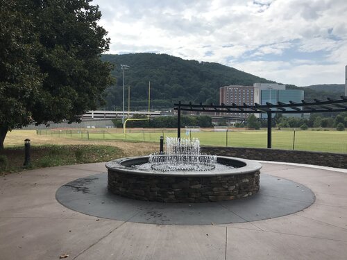
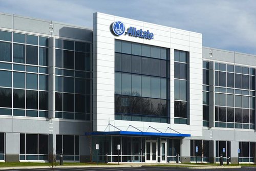
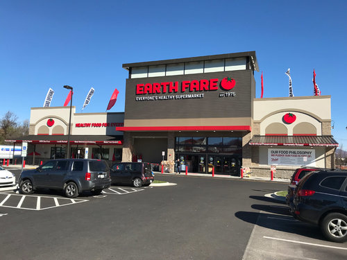
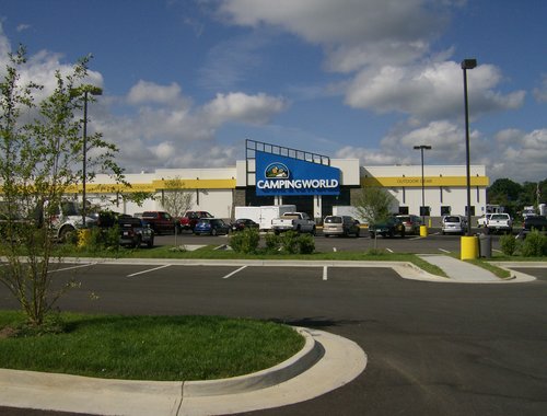
Take a look at how we've helped our clients.

District Vue

District Vue is a high end active lifestyle aparment complex in the City of Roanoke, Virginia. The 18 acre development included 324 apartment units, clubhouse, pool, and other amenities for its residents.

Learn More
River’s Edge North Park

River’s Edge North Park is one of Roanoke City’s premier outdoor athletic parks. This phase included high-end Bermuda grass athletic fields, walking trails, seat walls, landscape amenities, and upgraded parking facilities.

Learn More
The Retreat

The Retreat in Roanoke County is a 24 acre multi-family development with 12 apartments buildings and 252 apartments. In addition, 7.5 acres of commercial development acreage was created with this development.

Learn More
Allstate

This Allstate development in Roanoke County created a 70,000 square foot office building on 7.5 acres adjacent to Interstate 81. This project also included offsite roadway improvements and utility extentions.

Learn More
Ivy Market

Rezoning, full survey, and civil engineering plans for the planned commercial development along Franklin Road in the City of Roanoke featuring Mellow Mushroom and Earth Fare.

Learn More
Camping World

This 40 plus acre commercial planned development in Roanoke County consisted of road and utility extensions and the site development plans for Gander Mountain, Camping World, and Tractor Supply.

Learn More

Take a look at all of our projects.

Check out our entire project gallery to see our work in action, showcasing a variety of successful land surveying and civil engineering projects.

Get in touch.

Use the form below to contact us regarding your project. Please be as detailed as possible, including property address, if applicable. You may also email or call us to make an appointment. For job opportunities, please email us your resume or visit our careers page. We’re always looking for new and exceptional talent.
    © 2025 Lumsden Associates, P.C. | All rights reserved.